Bremen, 15 April 2024. Remote sensing data (images taken by satellites, aircraft or drones) is becoming increasingly important – especially when it comes to tackling specific environmental and climate challenges. However, traditional approaches to processing are now reaching their limits due to the constant increase in available geographic data. Automated solutions are therefore crucial to ensure efficient and sustainable urban planning. Against this backdrop, OHB Digital Connect is cooperating with the Bremen State Office for Geoinformation (GeoBremen) in a project called "Urban Feature Monitoring with Artificial Intelligence", or "Urban AI" for short. The aim of the project is to utilise artificial intelligence (AI) methods for urban planning.
Machine learning for sustainable urban development
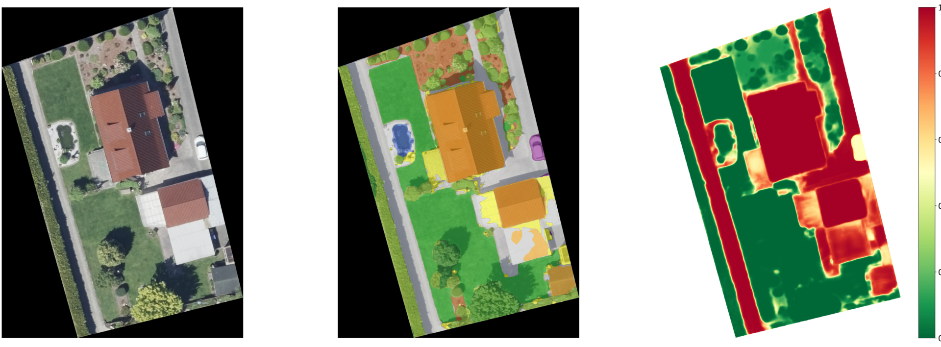
The use of machine learning methods can provide crucial insights for sustainable urban planning and development. The focus here is on methods and data products for the spatial recording of sealing levels and the identification of unsealing potential in urban areas. By recording and analysing data in this way, environmental impacts such as flooding or heat islands can be better understood and suitable measures can be taken.
Aerial survey data and information from the Authoritative Real Estate Cadastre Information System (ALKIS) provide the City of Bremen with the data basis for analysing and modelling the degree of sealing with the help of AI. The focus here is on deep learning techniques to recognise and use complex correlations in the data.
"Urban AI marks a significant advancement in the field of digital twins: we are gaining new ways of looking at Bremen, understanding it and making it more liveable," explains Ulrich Gellhaus, Head of GeoBremen. "The automated processing of mass data such as point clouds and raster data using AI in collaboration with OHB opens up completely new processes and utilises the potential of previously untapped information."
Close collaboration with GeoBremen
Both OHB Digital Connect and the Bremen State Office for Geoinformation play an important role in the cooperation project. OHB Digital Connect is responsible for deriving the technical requirements for various applications and developing methods and processing chains that are optimally tailored to the user requirements. GeoBremen provides support by providing these user requirements as well as relevant data and legal framework conditions. Evaluation and quality assurance are carried out in close co-operation between both sides. The project duration is 48 months.
Contact for media representatives:
Marianne Radel
Head of Corporate Communications
Phone: +49 421 2020 9159
Email: marianne.radel@ohb.de
Contact for investors and analysts:
Marcel Dietz
Investor Relations
Phone: +49 421 2020 6426
Email: ir@ohb.de