14 February 2022. In the fight against climate change, science and politics will very soon have a new weapon at their disposal: the German environmental satellite EnMAP (Environmental Mapping and Analysis Programme) has passed its final tests and is ready to be launched into space. The launch is scheduled for April 2022 from the Cape Canaveral Space Center in Florida/USA. From then on, a completely new era of Earth observation will begin with EnMAP. As a German environmental mission, this project by the German Aerospace Center, the German Federal Ministry for Economic Affairs and Energy and OHB will primarily focus on climate change and its impact on all ecosystems. On land and on water.
The earth in countless colours
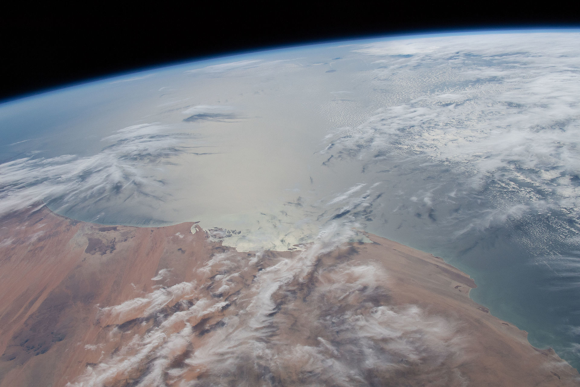
What is special and technologically spectacular about the satellite is how it works. EnMAP uses so-called imaging spectroscopy. This technology makes it possible to record a larger wavelength range, far beyond visible light, with multi-channel images. To obtain these so-called hyperspectral images, the satellite was equipped with a hyperspectral instrument developed by the OHB Center for Optics and Science in Oberpfaffenhofen near Munich. This instrument records the sunlight reflected by the Earth in the wavelength range between 420 nm and 2450 nm in exactly 242 narrow spectral bands arranged in a row and allows insights into the state of the Earth's surface which were previously not possible in this way.
All materials on the Earth's surface reflect sunlight in their own way, the technical term for this is spectral signature. The satellite's measuring instrument can display this signature in images, the aforementioned hyperspectral images. On the basis of these images and the colour spectra depicted, it is possible not only to determine materials precisely, but also to obtain information about how much of them has been found.
Many benefits for agriculture, nature and the environment
This information is of great practical use, especially in agriculture and forestry. The hyperspectral method can be used, for example, not only to identify the crops being grown in a field, but also to determine the mineral or water content of the soil. This, in turn, can help farms increase yields, because the EnMAP data shows exactly where there is too much or too little water and where there is too much or too little fertiliser. Transferred to the perspective of the entire planet, the relevance of these findings becomes immediately clear: According to a United Nations forecast, there will be around 11 billion people living on Earth in 2100. However, the area on which arable land and agriculture are possible is limited. Overall, it accounts for only about three per cent of the Earth's total surface, and the trend is downwards due to the expansion of cities and the progressive sealing of land.
However, the many people who will live on the Earth in the future must be fed. This is a huge challenge and can only be achieved through optimised agriculture. This will require finding better and more efficient ways to irrigate, fertilise, ideally determine harvest and cultivation times, and protect crops. All of this will ideally lead to higher yields and more efficient farming. This is made possible with the data from the hyperspectral instrument. The data makes it possible to detect nutrient deficiencies, water stress or pest infestations at an early stage and to respond with measures that help prevent crop failure.
This example describes quite well the indispensable contribution EnMAP will make to understanding the complex processes and feedback mechanisms in the Earth ecosystem. After all, the fate of a very large number of people on Earth will be decided on the issue of sustainable global land use. The satellite will be able to image the surface in different regions of the Earth at short intervals in high spatial and outstanding spectral resolution. This opens up completely new possibilities for scientists worldwide to understand the properties and composition of vegetation, soils and water and to derive development forecasts from them. These, in turn, will allow significantly better and more efficient decisions to be made regarding measures to combat environmental and climate problems.
In addition to the land surface, EnMAP will also take a close look at coastal areas and inland waters. The satellite will see details that remain hidden from the human eye. As if under a microscope, its hyperspectral instrument makes pollutants in lakes and coastal waters visible, and allows them to be quantitatively determined with precision. Where water samples used to be taken at great expense, in the future a glance from space will be enough to determine water quality over a large area. The same applies to mineral samples, for example to determine the degree of soil contamination. This can be useful after accidents in chemical factories, for example. Instead of exposing people to the risk of collecting samples on site, a risk-free view from space will suffice in the future.
The EnMAP environmental satellite is absolutely fascinating – it's basically a combination of a special laboratory and a microscope flying around the Earth at an altitude of 650 kilometres. This fascination, I admit, came to me only gradually. What I was able to grasp very early on as an entrepreneur, however, was of course how incredibly difficult it has been for our teams and the participating scientists from Potsdam over all those years to master the challenges of building the hyperspectral instrument in such a way that the desired results could be generated.
EnMAP will take the analysis of the Earth ecosystem to a new level
For our engineers at the Centre for Optics and Science, working on the hyperspectral instrument has been a technological challenge that has been on the edge of what is possible. For this reason, development also took much longer than originally planned. But now EnMAP is ready for launch. And I was pleased to see that the scientific community around the world is eagerly awaiting the launch of EnMAP, which will soon take place using a rocket from US space company Space X. The scientific community can hardly wait to incorporate the data, which was not previously available in this quality, into their research. I am convinced that EnMAP will take the analysis of the Earth's ecosystem to a new level. And I am very proud that this has been achieved through the efforts of science and industry from Germany.
Personal details:
Born in 1962, Marco Fuchs studied law in Berlin, Hamburg and New York. He worked as an attorney in New York and Frankfurt am Main from 1992 to 1995. In 1995, he joined OHB, the company that his parents had built up. He has been Chief Executive Officer of OHB SE since 2000 and of OHB System AG since 2011. Marco Fuchs is married and has two children.