
In the current global situation, strategic reconnaissance is becoming increasingly important – the Russian invasion of Ukraine on 24 February 2022 was the latest example of this. Satellite reconnaissance plays a special role in this context, as images can be taken from space from any point on the Earth's surface without violating the sovereign rights of other states. This means that information can be collected safely in the event of a conflict.
Dynamic situations, such as the war in Ukraine, require constant and targeted surveillance, which can only be guaranteed by a flexibly deployable, sovereign infrastructure. For this reason, Germany has had its own satellite reconnaissance system, called SAR-Lupe, since 2007. With the successor system SARah, which is currently being finalised, the next generation of reconnaissance satellites is about to be put into operational use.
The impetus for the procurement of Germany's own satellite reconnaissance system came, among other things, from the Kosovo war from 1998 to 1999. Although plans for a reconnaissance programme already existed before this, they originally envisaged a close partnership with France. The German part of the programme, a radar satellite called Horus, was ultimately rejected in 1998 for cost reasons. During the Kosovo war, however, it became clear that without its own satellite reconnaissance capabilities, Germany was heavily dependent on its NATO partner, the USA.
From individual satellites to satellite constellations
As this situation increasingly turned out to be a strategic disadvantage, alternatives were sought to the satellite development planned as part of the partnership with France. The result was a paradigm shift: instead of a single large satellite system, estimated to cost up to five billion Deutschmarks (around 2.6 billion euros), a constellation of five small radar satellites was to be realised. In reference to the measuring principle used by the satellites and their ability to record regions of particular interest with improved resolution, the project was christened SAR-Lupe, where SAR stands for Synthetic Aperture Radar. Original cost estimate: 370 million euros.
The contract for the realisation of SAR-Lupe by a European consortium led by OHB System AG as prime contractor was signed on 17 December 2001. The five satellites were launched – unthinkable today – between 2006 and 2008 from the Russian cosmodrome Plessezk using Kosmos-3M launch vehicles. The system has been operational since December 2007 and the full range of services has been available since 2008. All satellites are still operational today even after the mission duration contractually agreed in 2001 and are being operated by OHB.
What capabilities do radar satellites have?
The five satellites in the SAR-Lupe constellation are identical in design and orbit the Earth at an average altitude of 500 kilometres in near-polar orbits. As a payload, the satellites carry a SAR that allows high-resolution images to be taken from almost anywhere on Earth. Unlike optical systems, the satellites' ability to record images is hardly dependent on weather or light conditions. As radar satellites actively emit electromagnetic pulses that are only slightly affected by atmospheric turbidity, they continue to provide reliable images even in darkness and through dense cloud cover. In addition, radar pulses are particularly well reflected by water and metal, which means that infrastructure, vehicles and weapon systems can be recognised particularly well. In some cases, images can even be taken through trees, camouflage nets and the top layer of soil. Another advantage of radar satellites is that they can also precisely detect the speed of movement of objects and height differences in the terrain.
A special feature of the SAR-Lupe satellites is the ability to perform different flight manoeuvres depending on the mission scenario: in strip-map mode, the satellites capture large areas with moderate resolution while flying over them at a speed of around seven kilometres per second above the ground. These images primarily provide an overview of a given situation. For precise observation of particularly interesting targets, all satellites can also perform the so-called spot-light manoeuvre. During this manoeuvre, the entire satellite rotates as it flies over the target and partially compensates for its own movement, which extends the illumination time and achieves a significantly higher resolution in the direction of flight. Reaction wheels are used to align and stabilise the satellites during the various manoeuvres, while the existing chemical thrusters are primarily used for orbit control.
Image generation on the ground
The SAR-Lupe satellites themselves do not generate any images that can be interpreted by humans. The information recorded is merely captured as raw data from the radar echoes in the form of columns of numbers, stored on the satellites and transmitted to the ground segment in Germany at the next opportunity. It is only when the raw data is processed further on the ground that image products are created that can be analysed and interpreted by trained personnel.
From SAR-Lupe to SARah
SAR-Lupe was designed for a service life of ten years. The satellites have already exceeded this minimum service life by several years. Although they are still in service and provide reliable images, they are to be supplemented and eventually replaced by the successor system SARah in the near future, as the risk of malfunctions increases the longer the electronic components remain in space.
The realisation of SARah is currently in the final stages of implementation. OHB System AG is again acting as prime contractor, while the customer is the German Federal Ministry of Defence (BMVg), represented by the Federal Office of Bundeswehr Equipment, Information Technology and In-Service Support (BAAINBw).
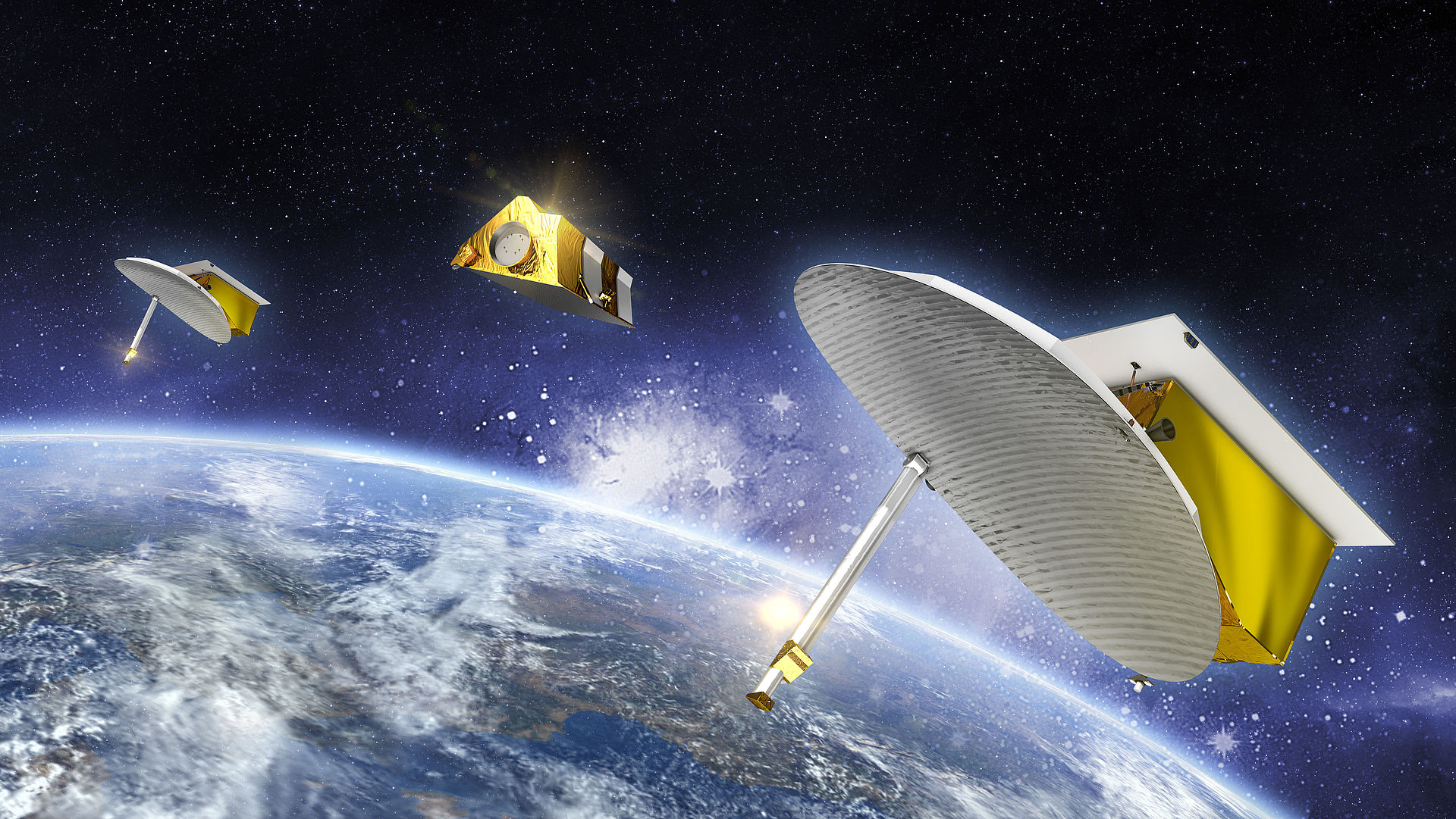
SARah is a direct continuation of the SAR-Lupe programme and comprises three satellites and two ground stations. Unlike SAR-Lupe, not all SARah satellites are identical: two are based on a further development of SAR-Lupe's proven reflector technology, while the third is a satellite with phased array radar technology. The latter is being provided by Airbus Defence and Space as the main subcontractor. By combining the different types of satellites, the advantages of the individual technologies can be utilised for the overall system. Compared to SAR-Lupe, the SARah system has an increased image resolution and scene size. Thanks to more storage capacity on the satellites, a larger number of images can be recorded per day. Furthermore, the use of several ground stations allows the recorded data to be transmitted to the ground more quickly. This can significantly reduce the system response time, i.e. the time from the request to the return of the desired images.
SARah-1, the phased array satellite manufactured by Airbus Defence and Space, was successfully launched on 18 June 2022 on a Falcon 9 rocket from Space Launch Complex 4 at Vandenberg Space Force Base in California. Shortly afterwards, it reached its target orbit and passed the performance tests, enabling the military user to start partial operation of the SARah system on 1 October 2023. The start of operational use of the first SARah satellite resulted in an increase in military reconnaissance capabilities. This is a decisive factor in assessing the current global security situation.
SARah-2 and SARah-3, the two reflector satellites built by OHB, are scheduled to begin their journey into space from Vandenberg Space Force Base in California in December 2023.