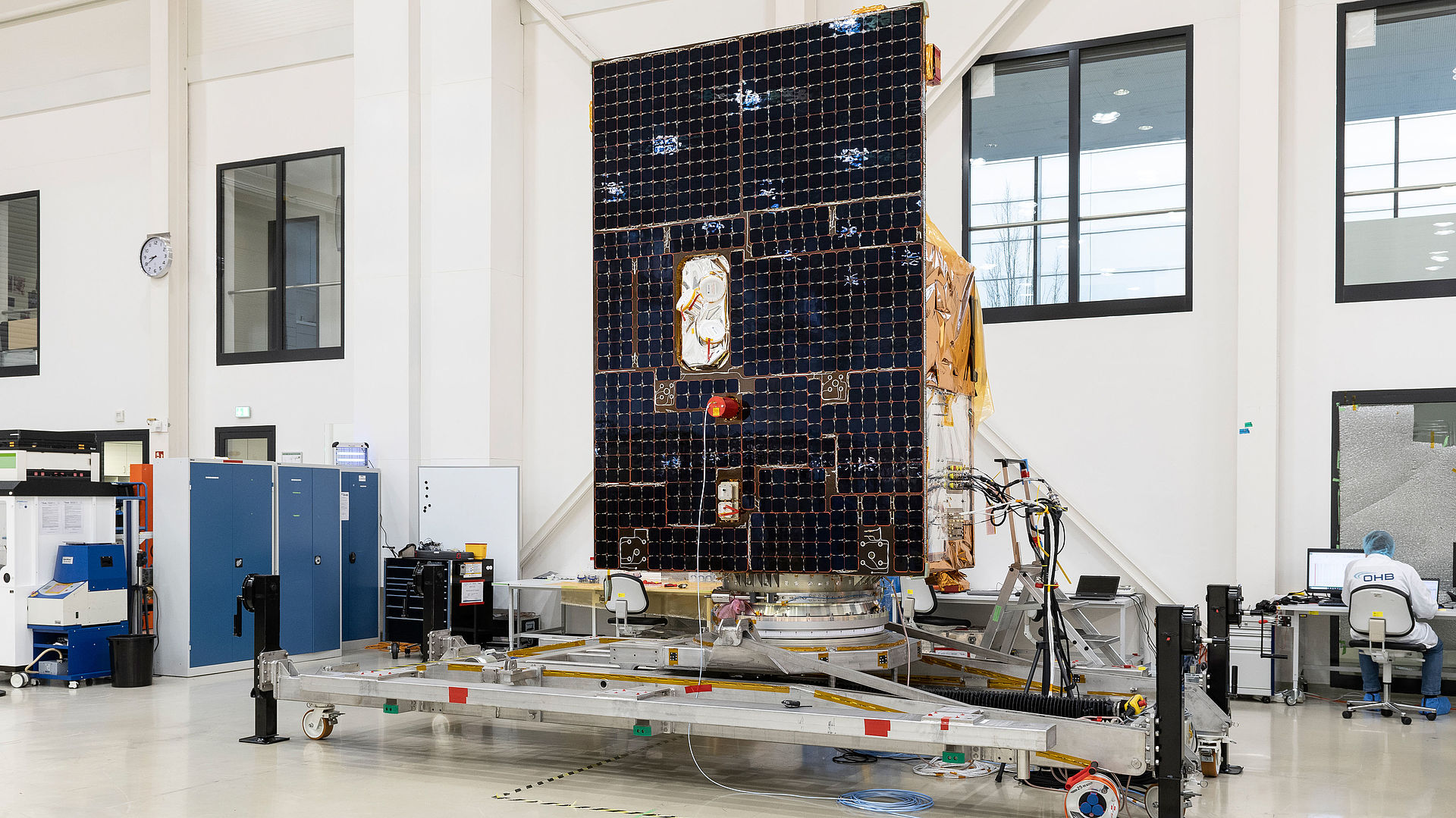
Superpowers are not only an essential part of a good Hollywood film; humanity also needs superhero powers to tackle the environmental and climate crisis. OHB System AG in Oberpfaffenhofen has developed and built a superhero known as EnMAP on behalf of the German Space Agency at DLR with funding provided by the German Federal Ministry for Economic Affairs and Climate Action (BMWK). The mission is under the scientific direction of GeoForschungszentrum Potsdam (GFZ). Three DLR institutes and facilities have been tasked with constructing and operating the ground segment: the German Space Operations Center in Oberpfaffenhofen will be carrying out and monitoring satellite operations, while the German Remote Sensing Data Center and the Remote Sensing Technology Institute will be responsible for archiving, processing and validating the satellite data and making it available for scientific research. Starting in spring 2022, the Earth observation satellite will be using imaging spectroscopy to diagnose the Earth’s surface and record environmental changes.
EnMAP will become an environmental observer for ...
... the forest
Data provided by EnMAP will improve forest management. This includes forestry mapping, monitoring of deforestation, the calculation of carbon storage and recording and predicting pest infestation. This benefit is of great significance given that detrimental environmental influences have been increasingly placing stress on our forests. So far, most of the damage has been assessed visually on site by forest officials – a gigantic act as 90 billion trees are spread over an area of 11.4 million hectares. Here, EnMAP will help to “scan” forests and thus determine the health of the trees and plants from an altitude of 640 kilometers.
... agriculture
The mission will be able to monitor harvests, improve the mapping of agricultural land, calculate crop losses and future yields and identify potential agricultural land.
... land management
Land planning will benefit from EnMAP’s data. In addition, the severity of land degradation, i.e. the deterioration of soil ecosystem services, will be assessed. Erosion maps and cadastral maps for the registration of land ownership and land use rights can be created using the data.
... water management
EnMAP will also aid water resource management as its data will help to map water and river basins. Flood control and disaster management will also benefit from this. So far, most of these tasks have been carried out locally – a mammoth task for which EnMAP’s remote sensing capabilities will lead to decisive improvements – and thus new superpowers.
The Earth in a myriad of colors: How does EnMAP work?
In order to understand how satellites observe the Earth, it important to first consider how human sight works. The information carrier for this purpose is the spectrum of electromagnetic radiation emitted by the sun. This ranges from hard X-rays with extremely short wavelengths (<0.1 nanometers) to long radio waves (>1 kilometer). Solar radiation reaches its highest intensity at wavelengths of between 380 and 780 nanometers. In the course of evolution, the human eye has adapted to this and is able to perceive precisely this range, which is why it is commonly referred to as “visible light”. Some of the remaining wavelength ranges are absorbed by the earth’s atmosphere, while others reach the Earth’s surface but are not perceptible to the human eye. These include UV and infrared radiation for example.
From the human eye to hyperspectral Earth observation
Irrespective of their perceptibility to the human eye, all types of radiation penetrating the atmosphere interact with the Earth’s surface and thus provide information about its composition. However, the human eye can only absorb a fraction of this information due to its limited sensitivity to the solar spectrum. The retina inside the eye has three different types of color receptors or cones, whose visual dyes have absorption peaks at different wavelengths but overlap to some extent in their sensitivity. The brain processes the activation of the individual cone types caused by the composition of the incoming radiation, translating it into a color image.
And what do the “eyes” of Earth observation satellites see?
Technical multispectral instruments usually have a higher spectral resolution than the human eye, but even a standard digital camera is a multispectral instrument. Like the human eye, the sensors in a digital camera can differentiate between blue, green and red light and thus reproduce the visual impression created by the eye. By contrast, however, far more complex multispectral instruments with up to fifteen color channels are used for Earth observation. They can usually detect different wavelength ranges of visible light and infrared radiation.
What makes a hyperspectral satellite so special?
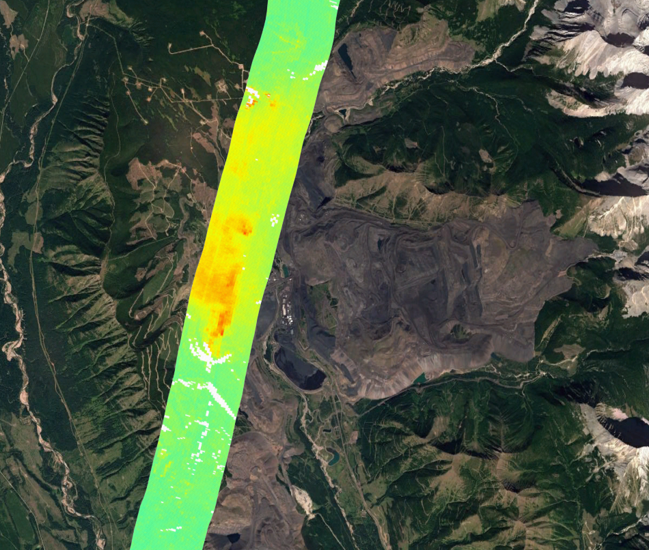
Hyperspectral remote sensing detects a large number of bandwidths along the light spectrum. This provides a rich treasure trove of data with a high spectral resolution that makes it possible to detect things and properties that are not visible to conventional imaging sensors. This makes it possible to render the invisible visible. With the EnMAP instrument, a continuous spectrum and thus a kind of “spectral fingerprint” of objects can be recorded. For example, different types of vegetation and different soil conditions can be identified on the basis of their characteristic absorption and reflection properties. The information density is so great that, for example, it is possible to distinguish plant groups and sometimes even individual plant species or rock compositions from a distance of several hundred kilometers. At the same time, the health of vegetation can be determined on the basis of the way infrared light is reflected: The leaves of healthy plants produce chlorophyll, which reflects six times more strongly in the infrared range than in the range of visible (and particularly green) light. This makes the EnMAP environmental mission looks pretty colorful. While the human eye sees three color channels and customary multispectral satellites four to ten color channels, the hyperspectral earth observations performed by EnMAP use over 240 continuous spectral bands at wavelengths between 420 and 2450 nanometers and a ground resolution of 30 m × 30 m (1 image pixel = 30 m × 30 m).
And then what? What becomes of all this superpower?
This data is mainly used in geographical remote sensing and environmental sciences. Hyperspectral data is usually not utilized for direct observation. Rather, it is evaluated and consolidated with other data sources in complex mathematical processes. The resulting information on a property of the surface in question can then be represented in thematic maps, for example biotope type distributions.

To protect your personal data, your connection to the video streaming provider has been blocked. Click to unblock the video streaming provider. By loading the video you accept the video streaming provider’s privacy policy. More information about the video streaming provider’s privacy policy can be found here: Google - Privacy & Terms