Nowadays, most weather data comes from space. The most important European weather satellites are the geostationary Meteosat satellites, which are operated by EUMETSAT, the European Organisation for the Exploitation of Meteorological Satellites.
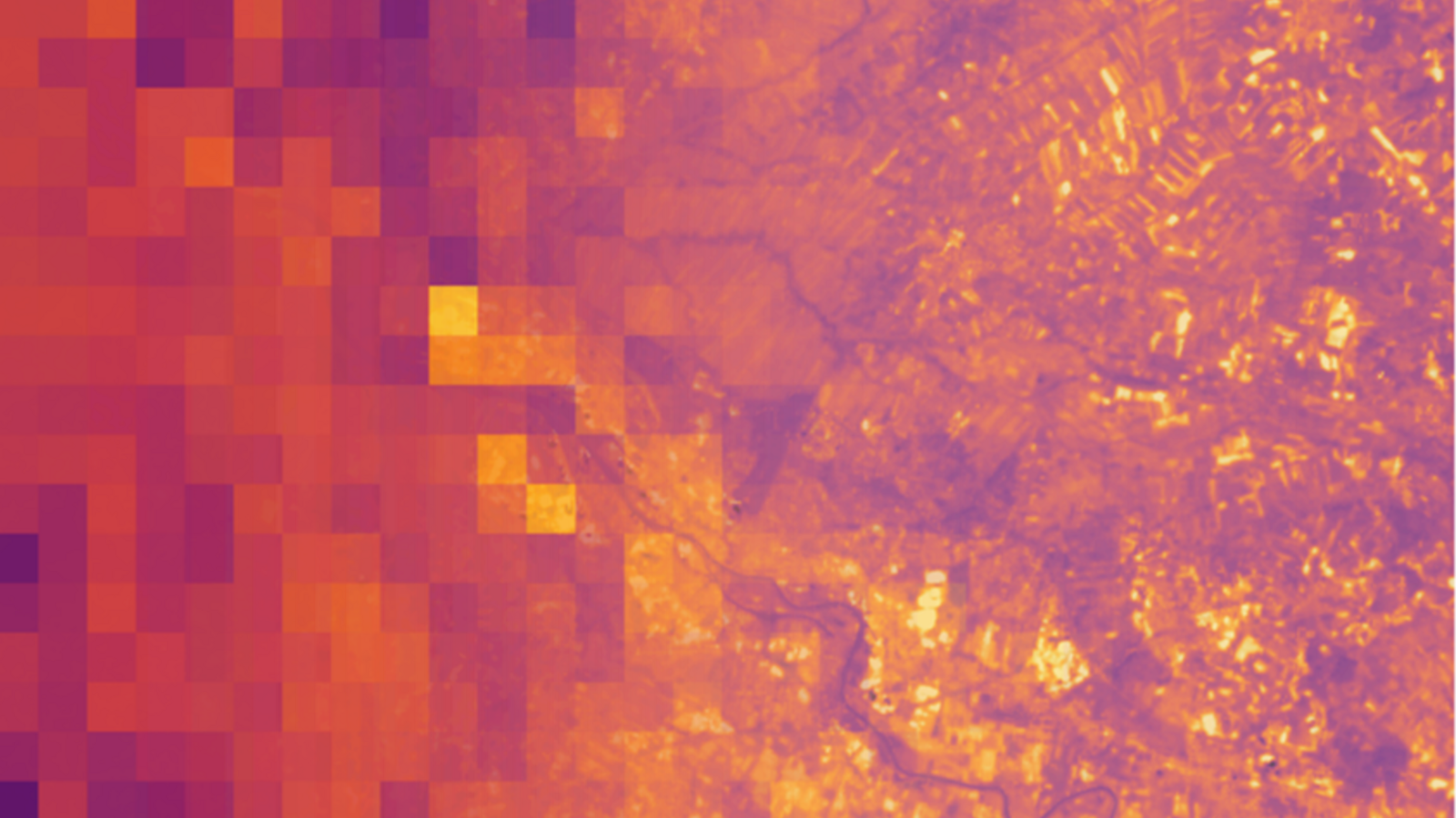
From their position at an altitude of just over 36,000 kilometers, geostationary satellites can capture the entire side of the Earth facing them; however, due to the great distance, the spatial resolution is rather low. For the first third-generation Meteosat satellite (MTG-I1), launched at the end of 2022, this resolution is one kilometer in the optical spectral range and two kilometers in the thermal infrared. This is sufficient to reliably predict the development of the general weather situation over Europe, but local extreme weather events can hardly be detected.
OHB Digital Connect is therefore currently working on behalf of EUMETSAT to improve the spatial resolution of the data provided by MTG-I1 using AI-supported super-resolution. In this process, multiple images are combined to achieve a higher level of detail. The images processed in this way will subsequently be incorporated into the climate models of the Belgian Meteorological Service and the weather models of the Swiss company Meteologix AG (part of the Kachelmann Group).
DestinE: Digital Twin of the Earth
The project, titled “AI/ML Application Demonstrator Using DestinE: Enhancement of Lower Resolution Products,” is embedded in the Destination Earth (DestinE) initiative, jointly carried out by the European Commission, the European Centre for Medium-Range Weather Forecasts (ECMWF), the European Space Agency (ESA), and EUMETSAT, whose goal is to create a digital representation of Earth that is as realistic as possible by 2030. The digital twin is intended to be used to monitor the effects of natural events and human activities on the Earth system, predict extreme weather events, and develop strategies to address climate-related challenges.
“AI-powered image processing is a key component of our downstream activities,” explains Arne Gausepohl, Head of OHB DIGITAL. “It enables us to make information accessible that provides a wide range of users with the basis for informed decisions.”
Implementation of new technologies
“This project serves as a prime example of how technologies that originated in research and development projects can be successfully translated into practical applications,” adds project manager Daro Krummrich. “Especially in the context of climate change and extreme weather, it is crucial that scientific innovations be integrated into operational systems quickly and effectively.”
The AI/ML model developed as part of the project will be made available as open source not only to the DestinE community but also to all other interested parties.