24 navigation satellites designed, engineered and integrated by OHB are orbiting around 23,000 kilometers above the Earth. Acting on behalf of the European Commission, the European Space Agency (ESA) awarded the contract for all first-generation satellites to OHB System AG, the principal contractor. Galileo gives Europe its own satellite navigation system. We have put together a list of the most frequently asked questions about Galileo, providing brief answers to them.
1. What is Galileo capable of?
The satellites transmit signals that can be received with recent smartphones or navigation devices. On average, Galileo positioning data is accurate down to a distance of 0.92 meters. In addition, Galileo offers a search and rescue (SAR) service, which can also be used in the maritime and aviation sectors. If a ship is in distress at sea, the crew can make an emergency call via a satellite transmitter, which also sends the ship’s position. The Galileo satellite receives the signal and forwards it to the emergency center on the Earth to ensure an immediate response.
2. What other applications use the Galileo system?
Standard time references are now possible in banking transactions thanks to the high-precision atomic clocks and the worldwide availability of the Galileo signal. This makes high-frequency trading much safer. Furthermore, the Galileo service helps to ensure that aircraft landings can be executed with extremely high accuracy and safety, without any need for a complex ground infrastructure.
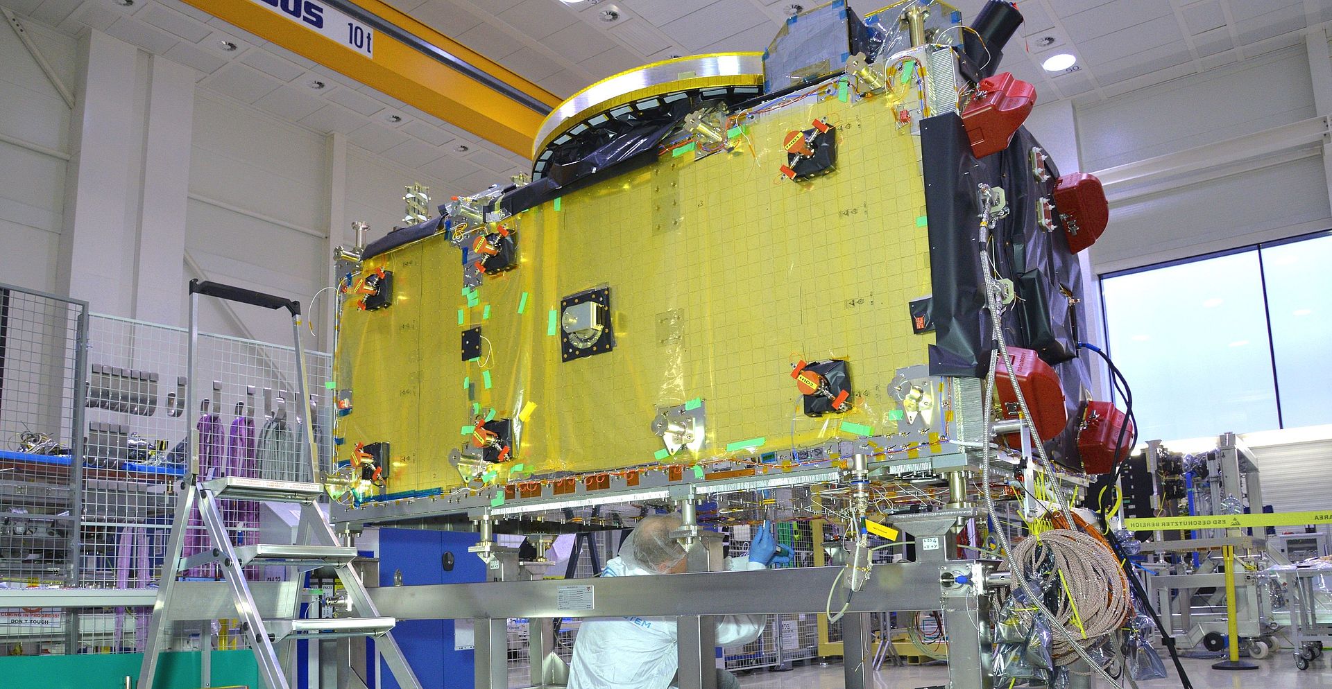
3. How expensive is a Galileo satellite and how big is it?
A satellite is worth about 40 million euros and is about 15 meters wide when its solar panels are fully extended.
4. Why does Europe need its own navigation system?
For a long time, only the US “Navstar GPS” global positioning system was being used in Europe. However, we now also use the Russian Glonass and the Chinese BeiDou systems. If, for example, GPS were suddenly to stop functioning or were switched off, this would have consequences for the entire economy and infrastructure.
5. Where can I see a list of Galileo-compatible devices?
The latest list is available at https://www.usegalileo.eu//.
6. Are the satellites also used for identifying the location of individual persons?
Don't worry, a normal user’s position is not identified. Imagine you’re sitting in a car and using the navigation device or smartphone for your route. In this case, the device regularly picks up a satellite signal, which it can use to calculate your exact position. A return channel to the satellite is not required for this and, indeed, no such channel is implemented at all.
7. How long will the satellites continue to operate?
Each satellite has a service life of around twelve years. However, this is only a theoretical figure; technically, there is no limit on the potential lifespan of the satellite.
8. What does it mean for OHB to be part of this major project?
The Galileo project has a terrific team. We started in 2007 with a team of about ten, culminating in about 150 people working on the project in peak periods. We have taken a very flexible and relaxed approach to the project. In this way, we have ensured that everyone is motivated and committed. We also look outside the box. Thus, with Galileo, we have developed and brought to fruition a longstanding flagship project for the OHB Group.